Pages

Saturday, March 7, 2009

Bike Tour - Bashang Grassland Ⅲ

Day3: July7, Fengning-Tucheng-Kulongshan-Datan, 80km

Today' distance was shorter, but the sun was still parching. The road to Tucheng,which means town of dirt, was dusty and bumpy. Alone the road some people were selling agate stones digged nearby. There was a grove of trees, which was named “Friendship Grove of China and Japan.”
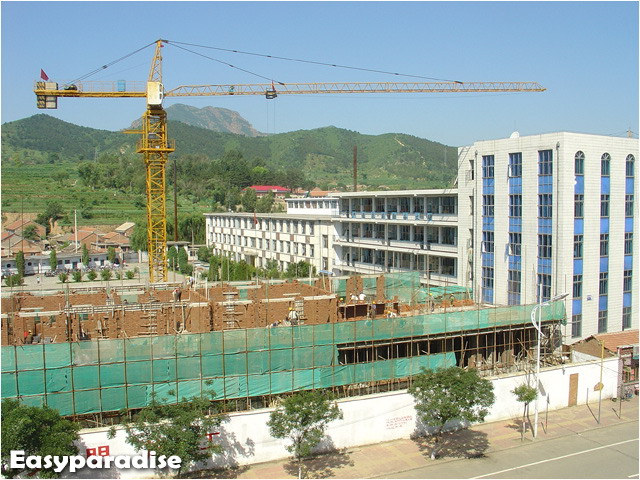
Fengning County

Friendship Grove of China and Japan

They said it’s a kind of agate

There were many singing grasshoppers in the bush, big and fat. I don’t have much time to shot those ugly guys. If you are curious about them, I’ll post them after I finish all posts about this trip.

We had an big beef meal in Kulongshan, a small town between Tucheng and Datan. The proprietor of the restaurant told us the steep slope ahead that up to the “Second Stair” was even a challenge to motorbikes…Dear me! Why the toughest sections always appeared in the ends of everyday——when we were out of energy. Fortunately, we always faced them with full stomaches.

You may wonder what “Second stair” is. Well, it’s something about Chinese geography. When you stare at a China’s topographic map, you can easily divide China’s territory into three parts. The first part contains the highest altitude regions, including Tibet and Qinghai province, that is the “First stair”. The east part is the lowest plain or hills. This is the “Third stair”. And the “Second stair” is the mid-altitude part between them. “Bashang” means “the top of the second stair”. That is to say, we were going to climb the second stair from the first stair. So we had to conquer the most horrible slope. The slopes that we rode previously were nothing compared with this.

I only pushed my bike about 500m here during the whole trip, while An Bo rode all the way. Although we felt very tired during the uprise, we felt good when we reached the top. Actually, it was not as terrible as we thought. Just believe in yourself, and you’ll do it.

At the foot of the “Second stair”

Looking from the slope

Flowers and slope

It’s really a long slope…

Now we had standed on the top of the “Second stair”. It’s the end of the toughest part, for there were no more long and steep slops in future days. Chasing the beautiful sunset, we arrived at Datan and lived in a farm house. Datan is also a part of the so called Bashang. People who do not want to go further often enjoy grassland here. But here was not our final destination.

The end of the 9km slope. 13 people had died in accidents when they drived down.

Hi, I’m An Bo

Sunset of grassland

sheep

Day4, July 8, Datan-Yuershan-Caoyuan-Duolun, 107km

The grassland of Datan has the reputation of “No.1 Grassland” north of Peking”. Although we had to go on riding today, I still want to see more. I got up early, took my bike and went out. What about An? He just prepered sleeping to photography.

Here are some photos of Datan’s grassland.

Morning of Datan Grasslands

Morning of Datan Grasslands

Morning of Datan Grasslands

Morning of Datan Grasslands

Morning of Datan Grasslands

Flowers on grassland

Myself

Seeing from a small hill

I hadn’t posed well when the shutter started~~

An Bo just woke up when I was back. We packed our packages, had breakfast and went Duolun.

It’s still a hot day. Maybe I ate too much in the morning, I got collywobble. After taking some pills, I felt better.

We rode before the wind today. The road is in high quality and no many slopes. However, riding on vast grassland could be tedious. The road was long and straight without any other landscape but grass. What worse, we couldn’t find any shadows under the sunshine! Because there were no trees on the flat grassland. Sometimes we might feel the road was endless.

A lot of larks were singing in the grass. An Bo recorded their beautiful voices by cell phone for his father, who was crazy about feeding larks.

After we had rode a long time, we realised that we were not going the planned path. We don’t know which way it was but sure it was correct way to Duolun as the signspots had showed. So the line Day4 on the map is only the POSSIBLE way, might not be actual path we’ve covered.

We finished today’s task in only 7 hours. Duolun is a county of Inner Mongolia. We had a big Monglian meal that night, including milk tea, finger mutton, dried milk cake and Mongolian noodles. The hotel was fine but economical, and the night of “Second stair” was cool. That was the most comfortable night since we came out.

My “chocolate legs”

Look at the flag, we rode before the wind

Road on grassland plain

Road on grassland plain

Road on grassland plain

We Arrived at Duolun

More About the Trip

Bike Tour - Bashang Grassland Ⅰ
Bike Tour - Bashang Grassland Ⅱ View Map
Bike Tour - Bashang Grassland Ⅲ View Map
Bike Tour - Bashang Grassland Ⅳ View Map
Bike Tour - Bashang Grassland Ⅴ View Map
Bike Tour - Bashang Grassland Ⅵ View Map1 Map2

Friday, March 6, 2009

Bike Tour - Bashang Grassland Ⅱ

Day1: July 5, Beijing-Huairou-Liulimiao, 120km

We delayed some time in the morning, so it was already about 11:00 when we set off from a market——in which we added some odds and ends. It rains lightly, much comfortable than the previous days. However, we had to slow our speed down, because An’s bike had no mudguards, and we wonder whether it would continue raining in future days.

Let’s go!

There was an accident after we left Siyuan Bridge. An Bo crashed onto a bus while he’s trying to right the ring on the handlebar. Fortunately, he wasn’t injured seriously, but he’s so angry that he smashed the hellish ring into pieces…

At such a low speed, we arrived at Huairou at about 4:30 p.m. We had our lunch, or dinner. There were mountains in front. We began to ride the long slope up and down as the day went darker and darker. It’s still about 50km to our planned station, Tanghekou. Well, it seemed impossible for us to finish the task in a totally dark night on mountains. The coming light rain forced us to make the decision that live in Liulimiao tonight.

There were mountains in front

Day2: July 6, Liulimiao-Tanghekou-Labagoumen-Fengning, 95km

What a fine day today! We cleaned our bikes in the country yard we lived last night and started today’s journey. All we had to ride are mountain roads today. The beautiful summer sunshine, however, was more terrible than rain at that time.

Soon we arrived at Tanghekou, the place where we should had stayed in last night.

Riding up on slopes is laborious, but rushing downhill is fantastic. That’s the happiness of the sport. Actually, there was not many special things today. What we faced was only mountains. But the air was fresh and the sencery was enjoyable.

The hot weather made us sweaty. It’s likely that we would arrive very late again. So I tried my best to ride at a much higher speed without a break until I reached Labagoumen. After that, I even felt energetic instead of previous weary. 20minutes later, An Bo appeard. it’s time for dinner! Oh I’m so hungry…

What was waiting for us after delicious food? Sweet dreams? No, it’s not over yet! Today’s destination was Fengning, still 45km away. And we had to conquer the longest slope. OMG!

30km to Fengning(L); the annoying slope(R)
mountains of Labagoumen
mountains and slope

Fortunately, I was in good shape that day. Using low gears, I kept riding at a low but even speed. 2 hours later, the 20km slope was over. The time we reached the top, which is also the border of Beijing and Hebei Province, was about 8:00 p.m.

After taking some photos hurriedly, we rushed down for another 20km, which was the best prize for our effort. At 9 o’clock, we arrived at Fengning County. The day ended up with a big water melon and Schwarzenegger’s Jingle All the Way.

we succeed at last
the sunset clouds
Border of Beijing and Herbei Prov.
More About the Trip

Bike Tour - Bashang Grassland Ⅰ
Bike Tour - Bashang Grassland Ⅱ View Map
Bike Tour - Bashang Grassland Ⅲ View Map
Bike Tour - Bashang Grassland Ⅳ View Map
Bike Tour - Bashang Grassland Ⅴ View Map
Bike Tour - Bashang Grassland Ⅵ View Map1 Map2

Thursday, March 5, 2009

Be Interested in CHINA?

If you’re interested in my nation, here I strongly recommend you Discover China, three books written by Agang after his 500 day’s China tour. More than 3,000 pictures truely recorded the 31 cities and provinces of China mainland. You won’t have any difficulties in reading, because the books were published in both Chinese and English.

You may click here to read in the author’s blog, or click here to read English version directly, or click here to view his photoblog web album.

You can also search "Discover China Agang" or "走遍中国 阿纲" on Google.

The following are original descriptions of the books.

The author Agang, started his journey in September of 2005. During his 500 days’tough journey, he has gone through 31 provinces of China and taken more than 10 thousands photos(3240 chosen photos)and written over 170 thousands words as well.

Providing a lot of information about unknown geography, landscapes as well as humanities, this book can be a good travel guide for people to tour those places with original cultures and customers. At the same time, it can give lots of reference to the photographers, because the large photos in this book all reserve the original dates of photographing.

In addition, the most value part of this book lays in that the author hold the transcendent idea of “when taking photography, freedom can be got if one do not take photographing as a kind of art.” He took a lot of photos, which reflect the honesty, the kindness as well as the beauty of Chinese people. The rich photos with humorous or sharp words give readers a wonderful reading experience, that is, they can feel the uncover trueness and unfettered freedom of those places and those people.

The 500-day journey is a very tough one; the author and his team have overcome numerous difficulties and frustrations. Actually, it is a journey only people who have confidence and courage can make it. The author of this book,deviated from the mainstream values in order to break the traditional value bound in people’s mind.

The over 3000 photos were picked up from the total 10 thousands. And each of these photos has its own unique story and can reflect something, for instance, the blaze of humanity and wisdom of life. When reading it, one can not only enjoy the beautiful scenery of China but also can benefit from the sprits included in it.

The author’s Blog is very popular on the Internet with total clicks of more than 3 million. One of the netizens says like that,“touched by Agang’s work very much, I plan to share it with my wife and children.”…So many readers recall their old lives when reading Agang’s work. They are touched by those past feelings a lot.

There are three books in all with big 12k, the color printing as well as 612 Coated Paper, this book is bound very well. And with Chinese and English versions together, it can be well understood by Chinese and foreigners. So it can be a book for permanent collection and repeat reading. This book records a lot of information about the history and culture of China from 2006 to 2007. From the pre-photographing to the last publication, it spent 3 years to finish the book. With the large scope of its filming and the great amount of information it contains, this book is unprecedented. These elements will become more and more precious with the time passing by.

——Discover China by Agang

Wednesday, March 4, 2009

Bike Tour - Bashang Grassland Ⅰ

Bashang is the area on the border of Heibei and Inner Mongolia. The vast extented temperate grassland there is paradise for shutterbugs, especially for those who live in Beijing.

You might have known that I’m an amateur in photography and bicycle. I was watching a map when the idea that going to Bashang Grassland by bicycle hit me. Soon I began to collect information about the travel. I benefited a lot from people who had already achieved it and put their stories on internet. I made my own route and schedule. Then I found An bo and Hu Chu as my partners.

Our final destination was Ulanbutong, or Hongshan Army Horse Ranch, located in Inner Mongolia, far away from Beijing. Actually, that was the first time for all of us to ride such a long distance——over 500km!Facing the great challenge, what we have to do was plenty of preparation, such as equipments, medicine, tools, etc. Before setting off, we made a short distance ride to Shidu as train. Well, after that, Hu Chu gave up. That having no any experience of distant riding made him tired out.

After a month’s preparation, An Bo and I set out on July 5, 2008. In the following 12 days, we rolled 1,100km, crossed Beijing, Heibei and Inner Mongolia. The following are figures of the tour.

Date: July 5, 2008-July 16, 2008

Route: Beijing-Huairou-Fengning-Datan-Duolun-Yudaokou-Jixielinchang-Ulanbutong-Jixielinchang-Weichang-Chengde-Luanping-Gubeikou-Miyun-Huairou-Beijing

TRIP DIST (km): 1123.3 TRIP TIME: 62:44 AVG. SPEED: 17.90 MAX. SPEED: 62.42

And I have to say THANK YOU to all “Sunnys” for your help and advices.

I’m sorry I cannot continue today because writting in my awkward English is really a hard work…

I'll finish it in several days, thanks for reading…

More About the Trip

Bike Tour - Bashang Grassland Ⅰ
Bike Tour - Bashang Grassland Ⅱ View Map
Bike Tour - Bashang Grassland Ⅲ View Map
Bike Tour - Bashang Grassland Ⅳ View Map
Bike Tour - Bashang Grassland Ⅴ View Map
Bike Tour - Bashang Grassland Ⅵ View Map1 Map2

Sunday, March 1, 2009

"Love Flower” Dicentra spectabilis

5/1/2008, Beijing Botanical Garden
5/31/2008, Mount Wuling
5/1/2008, Beijing Botanical Garden

The Dicentra spectabilis also known as bleeding heart, which is one of my favourite flower species. They are widely distributed in north China and have been cultivated. There’re still two or three months before we can see the flower again. These photos are taken last year.

Too know more about Dicentra spectabilis, Click here or here(Chinese).